地理选考知识点(干货分享A-level地理A)
CIE A-level地理,可以学习水文和河流地貌、大气和天气、岩石和风化、人口变化和沉降动力学等课题。教学大纲涉及从热带到干旱的一系列环境,学生还可以学习诸如环境管理、全球相互依存和经济转型等topic。

今天我们给大家分享的是A-level的地理学习笔记:Deltas and Estuaries 三角洲和河口
IntroductionDeltas are features found where rivers that contain much sediment flow into the sea; velocity is reduced and deposition of material occurs. They are 3-dimensional features with most deposition occurring below the water surface.
三角洲是含有大量沉积物的河流流入大海的地方;速度降低,发生物质沉积。它们是三维的特征,大部分沉积发生在水面以下。
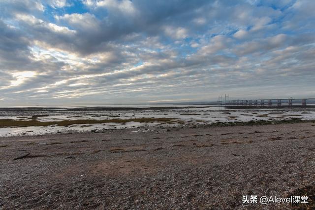
Estuaries are where fresh water (rivers) and salt water (sea) interact. They attract industry and settlement due to their provision of:
- Flat land.
- Water supply.
- Deep water.
- Food.
- Transport.
河口是淡水(河流)和盐水(海洋)相互作用的地方。它们吸引了工业和定居,因为它们提供了。
- 平坦的土地。
- 水供应。
- 深水。
- 食物。
- 运输。
For example, Avonmouth on the Severn estuary.

Not all rivers have deltas at their mouths and they vary greatly on size and shape. According to geomorphologists, there are 3 main estuary shapes:
- Accurate: Rounded, convex edges. For example, the Nile.
- Cuspate: Material evenly spread from the river.
- Birds foot: Spread over a wide area with many 'distributaries' extending out to sea. For example, Mississippi.
并非所有的河流在其河口都有三角洲,它们在大小和形状上有很大的不同。根据地貌学家的说法,有3种主要的河口形状。
- 准确的: 圆润的、凸起的边缘。例如,尼罗河。
- 尖锐型: 材料均匀地从河中散开。
- 鸟足状: 分布在一个广泛的区域,有许多 "分布 "延伸到海上。例如,密西西比河。
Deltas build up over time and on the diagram, 3 beds are visible:
- Bottom set: Have finest material, carried furthest in suspension and sinks to sea bed.
- Foreset: More readily deposited, coarser material. Builds out to sea.
- Topset: Deposits from river with the most coarse material.
三角洲随着时间的推移而建立起来,在图上,可以看到3个床。
- 底层集:有最好的材料,在悬浮物中被带得最远,并沉入海床。
- 前层:更容易沉积,物质更粗。更容易沉积,材料较粗。建立在海面上。
- 顶层:从河流中沉积的最粗的物质。
Factors influencing formation of deltas:
- Amount and type of sediment available.
- Variations in volume of water discharged from river.
- Aspect and geometry of coast.
- Coastal processes in operation, for example, wave action.
- Changes in coast level.
- Impacts of climate on growth of vegetation and marine organisms.
Deltas are especially favourable for agriculture, due to the deposition of fine sediment, but at the same time are places of high flood risk as shown by the Ganges Delta.
影响三角洲形成的因素:
- 可用的沉积物的数量和类型。
- 河流排放水量的变化。
- 海岸的角度和几何形状。
- 运作中的海岸过程,例如,波浪作用。
- 海岸线的变化。
- 气候对植被和海洋生物生长的影响。
由于细小沉积物的沉淀,三角洲对农业特别有利,但同时也是高洪水风险的地方,如恒河三角洲所示。

Essentially where rivers and coasts meet. They are often important wildlife habitats, but equally attract human settlement: in the UK, approximately 20 million people live near to estuaries, due to their flat building land. They exist where either a coastline has been raised - meaning that the lower area of the river is drowned or the coastline has subsided. The fact that salt marshes can develop distinguishes then from Rias.
基本上是河流和海岸的交汇处。它们通常是重要的野生动物栖息地,但同样吸引着人类定居:在英国,大约有2000万人居住在河口附近,因为它们是平坦的建筑用地。它们存在于海岸线被抬高的地方--意味着河流的下部区域被淹没或海岸线下沉。盐沼可以发展的事实使其与里亚斯相区别。
,免责声明:本文仅代表文章作者的个人观点,与本站无关。其原创性、真实性以及文中陈述文字和内容未经本站证实,对本文以及其中全部或者部分内容文字的真实性、完整性和原创性本站不作任何保证或承诺,请读者仅作参考,并自行核实相关内容。文章投诉邮箱:anhduc.ph@yahoo.com